World Map Vocabulary

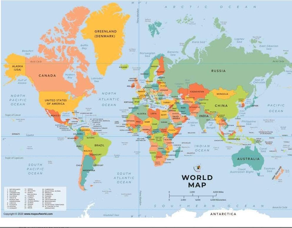
World Map (विश्व नक्शा) (वर्ल्ड मैप):
- The world map displays all the continents and oceans.
- विश्व नक्शा पर सभी महाद्वीपों और समुंद्रों को दिखाता है।
- Pronunciation: द वर्ल्ड मैप डिस्प्लेज़ ऑल द कॉन्टिनेंट्स एंड ओशन्स.
Continents (महाद्वीप) (कॉन्टिनेंट्स):
- Asia is the largest continent in terms of land area.
- भूमि क्षेत्र के मामले में एशिया सबसे बड़ा महाद्वीप है।
- Pronunciation: एशिया इज द लार्जेस्ट कॉन्टिनेंट इन टर्म्स ऑफ लैंड एरिया.

Oceans (महासागर) (ओशन्स):
- The Pacific Ocean is the largest ocean in the world.
- पैसिफ़िक महासागर दुनिया में सबसे बड़ा महासागर है।
- Pronunciation: द पैसिफ़िक ओशन इज द लार्जेस्ट ओशन इन द वर्ल्ड.

Equator (भूमध्यरेखा) (इक्वेटर):
- The equator divides the Earth into the Northern and Southern Hemispheres.
- भूमध्यरेखा पृथ्वी को उत्तरी और दक्षिणी गोलार्ध में बाँटती है।
- Pronunciation: द इक्वेटर डिवाइड्स द अर्थ इंटू द नॉर्दर्न एंड सदर्न हेमिस्फ़ियर्स.
Geography (भूगोल) (जिओग्राफ़ी):
- Geography is the study of the Earth’s physical features.
- भूगोल पृथ्वी की भौतिक विशेषताओं का अध्ययन है।
- Pronunciation: जियॉग्राफी इज़ द स्टडी ऑफ द अर्थ्स फिजिकल फीचर्स.

Longitude (देशांतर) (लॉंगिट्यूड):
- The Prime Meridian is the starting point for measuring longitudes.
- प्राइम मेरिडियन देशांतरों को मापन करने के लिए आरंभिक बिंदु है।
- Pronunciation: द प्राइम मेरिडियन इज द स्टार्टिंग पॉइंट फॉर मेज़रिंग लॉंगिट्यूड्स.

Latitude (अक्षांश) (लैटिट्यूड):
- The Tropic of Cancer is located at 23.5 degrees north latitude.
- कर्क रेखा 23.5 डिग्री उत्तर अक्षांश पर स्थित है।
- Pronunciation: द ट्रॉपिक ऑफ कैंसर इज लोकेटेड एट 23.5 डिग्रीज नॉर्थ लैटिट्यूड.

Cartography (नक्शाचार) (कार्टोग्राफी):
- Cartography is the art and science of map making.
- नक्शाचार नक्शा बनाने की कला और विज्ञान है।
- Pronunciation: कार्टोग्राफी इज़ द आर्ट एंड साइंस ऑफ मैपमेकिंग.
Topographic Map (भूखंडीय नक्शा) (टॉपोग्राफिक मैप):
- A topographic map shows the elevation and terrain features of an area.
- भूखंडीय नक्शा किसी क्षेत्र की ऊंचाई और भू-यान्त्रिकता की विशेषताओं को दिखाता है।

